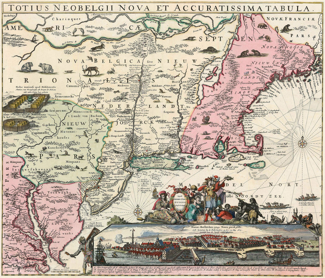
The map of Jansson-Visscher
The famous Jansson-Visscher map of New Netherland was first released in 1650. The map listed the names of numerous indigenous tribes and settlements, which suggests that the Dutch traders knew the importance of knowing the names of their indigenous suppliers and where they lived. It makes this map an important resource for anyone who wants to study the history of the original inhabitants of North America.
This map provides a detailed view of the area that, by 1650, was known as New England. At the time, map making was big business and demand was high. Maps like this were made for decorative reasons. It would however be inaccurate to say that their content was insignificant. In fact, they were detailed, accurate, and are important resources for research.